


Australia, often referred to as “The Land Down Under,” is a vast and rugged country that offers some of the most challenging and rewarding wilderness routes on Earth. The heart of Australia—the Outback—is a land of extreme contrasts: scorching heat, barren deserts, vast plains, and remote deserts, all surrounded by stunning natural beauty. Traversing this land, whether from south to north or east to west, presents an unparalleled test of endurance, navigation skills, and resilience.
This article examines two of the most iconic and challenging journeys across Australia: the South to North Crossing and the East to West Crossing. It delves into the routes, logistics, preparation, safety, and historical context, while also providing practical advice for anyone considering undertaking these treks.
1. Introduction: The Australian Outback—A Land of Extremes
Australia’s Outback is not just a geographical region but a symbol of adventure, isolation, and resilience. Spanning almost 70% of the country’s total landmass, the Outback is often considered an untouched frontier, with few human settlements and vast stretches of wilderness. The Outback is characterized by:
- Desolate Plains: Arid and flat, with little vegetation, especially in the Simpson Desert and Great Victoria Desert.
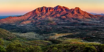
- Imposing Mountain Ranges: From the Flinders Ranges in the south to the MacDonnell Ranges in the center, offering rocky terrain and deep gorges.
- Ancient Rock Formations: Including famous landmarks like Uluru and Kata Tjuta.
- Remote Salt Lakes: Such as Lake Eyre, which is often dry but can flood during rare rain events, attracting millions of birds.
Traversing this expanse is a formidable task. Both the South to North Crossing and the East to West Crossing are monumental undertakings that require meticulous planning and specialized skills. They demand an understanding of the Outback’s unpredictable environment, from scorching heat and flash floods to sudden storms and treacherous terrains.
2. South to North Crossing: From the Southern Ocean to the Tropics
The South to North Crossing of Australia is one of the most iconic and challenging overland routes. Spanning from Port Augusta in the south to Cairns in the north, this route crosses through the heart of Australia’s arid interior and offers a dramatic transition from the temperate climate of the south to the tropical conditions of the north. The route is about 2,400 kilometers (1,500 miles) long, though the journey can be extended depending on the specific path taken.
2.1 Key Highlights and Route Overview
- Port Augusta: Located in South Australia, this town marks the starting point for many Outback adventurers. From here, the route heads north through the Flinders Ranges, offering striking views of the rugged mountains and deep valleys.
- Arkaroola: A popular stop within the Flinders Ranges, offering access to some of the Outback’s most remote and picturesque landscapes.
- Coober Pedy: Famous for its underground homes and opal mining, Coober Pedy is the first major Outback settlement encountered on this route. The town lies in the heart of the Stony Desert, where temperatures can reach up to 50°C (122°F) in the summer months.
- Lake Eyre: Australia’s largest salt lake, located in the middle of the country. It’s an inhospitable place, yet it holds a unique ecological significance. Lake Eyre only fills with water after rare and significant rainfall, creating a temporary haven for birdlife.
- Alice Springs: Located near the heart of the country, Alice Springs is an iconic stop for South to North travelers. From here, travelers will need to navigate the MacDonnell Ranges and head further north to the tropical regions of Queensland.
- Cairns: The northern terminus of the journey, Cairns offers access to the Great Barrier Reef and the lush rainforests of Far North Queensland. The contrast from the arid Outback is stark, providing an extraordinary visual and climatic transition.
2.2 Challenges of the South to North Crossing
- Climate Variability: The journey starts in temperate weather and climbs into increasingly hot and humid conditions. Travelers must be prepared for extreme heat in the Simpson Desert and Stony Desert, as well as the humidity and rain of the tropical north.
- Road Conditions: Much of the journey crosses unsealed roads and dirt tracks, which can become impassable after heavy rains. Water crossings and sand dunes are common obstacles in certain sections.
- Isolation: Some parts of the journey, particularly the stretches between Coober Pedy and Alice Springs, have limited access to resources such as fuel, food, and water.
- Wildlife: Travelers must be cautious of the region’s wildlife, including venomous snakes, spiders, and even large animals such as camels and kangaroos, which can pose a risk to vehicles and travelers alike.
2.3 Preparation and Logistics
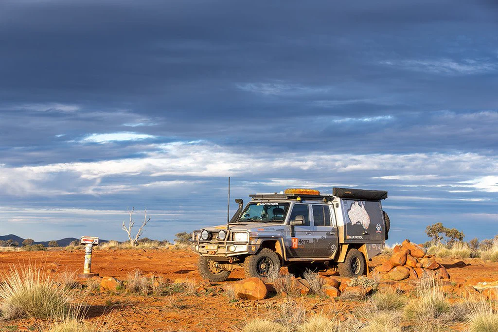
- Vehicle: A reliable 4WD (four-wheel-drive) vehicle is essential for this journey. The vehicle must be capable of handling rough, uneven tracks and should be equipped with sand tires for navigating dunes.
- Fuel and Water: Carry sufficient fuel for long stretches where refueling stations are sparse. Water is the most critical resource in the Outback, and having a water filtration system and enough supplies for several days is essential.
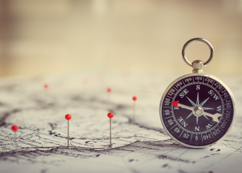
- Navigation Tools: GPS, satellite phones, and detailed topographic maps are necessary for both navigation and emergency communication.
- Weather Monitoring: Understanding weather patterns is essential. Sudden storms can cause flash flooding, while extreme temperatures can put strain on both travelers and equipment.
3. East to West Crossing: From the Pacific Ocean to the Indian Ocean
The East to West Crossing spans from the Pacific Ocean in Cairns, Queensland, to the Indian Ocean in Perth, Western Australia. This route offers a diverse array of landscapes, transitioning from coastal rainforests to arid deserts and salt flats, covering a distance of about 3,500 kilometers (2,175 miles).
3.1 Key Highlights and Route Overview
- Cairns: The starting point, offering access to the Great Barrier Reef and lush tropical rainforests. From here, travelers journey through the Atherton Tablelands and head into the Savannah Way, a region of tropical woodlands.
- Mount Isa: Located in Queensland, this mining town marks the transition into the Channel Country, a vast desert region with claypans and salt lakes.
- Alice Springs: As with the South to North Crossing, Alice Springs is a major waypoint. The crossing from east to west necessitates crossing the MacDonnell Ranges and heading into the Simpson Desert.
- Nullarbor Plain: This vast, flat expanse is a unique highlight of the East to West Crossing. The Nullarbor is famous for its seemingly endless road, a barren and windswept stretch of desert that spans 1,200 kilometers from east to west. Travelers crossing this region often encounter surreal experiences, from the desolate landscapes to the eerie silence of the wilderness.
- Perth: The destination on the Indian Ocean, offering a transition from the harsh Outback to the coastal beauty of Western Australia.
3.2 Challenges of the East to West Crossing
- Diverse Terrain: Unlike the South to North route, this journey features diverse terrain, from tropical rainforests to the arid wilderness of the desert. The Nullarbor Plain presents specific challenges, with minimal resources and long stretches without fuel or water supplies.
- Isolation: Like the South to North route, isolation remains a key challenge. Many stretches, especially through the Nullarbor, are devoid of towns or emergency services.
- Weather Extremes: Crossing through both tropical and desert climates requires adaptability. In the desert, temperatures can exceed 45°C (113°F), while tropical regions can be prone to torrential rains and cyclonic storms.
3.3 Preparation and Logistics
- Vehicle: A 4WD vehicle is also essential here, especially for the Nullarbor and desert regions. Extra care should be given to tire condition due to the rocky, uneven terrain.
- Fuel and Water: Again, sufficient water and fuel are paramount. The Nullarbor, in particular, has only a few fuel stations and is a region where travelers need to plan well in advance.
- Communication Tools: Given the isolation, reliable communication tools, including satellite phones, are a must.
- Navigation: A detailed route map and GPS system are necessary for ensuring accuracy, especially in areas with limited signage or infrastructure.
4. Key Considerations for Both Crossings
Regardless of whether one chooses the South to North or East to West route, there are several universal factors to consider:
- Safety: Always inform someone of your route and expected timelines. Outback travel is dangerous without proper planning.
- Health: Carry a well-stocked first aid kit, including medications for heatstroke, dehydration, and potential injuries.
- Mental Resilience: The Outback’s vastness and isolation can affect travelers psychologically. Preparation for long stretches of monotony and remote areas is crucial.
- Respect for the Environment: The Outback is ecologically sensitive. Travelers should respect local conservation efforts and Aboriginal cultural sites.
5. Conclusion
The South to North and East to West crossings of Australia are among the most iconic and challenging overland routes in the world. Whether traversing the desert plains of the Simpson Desert, the tropical rainforests of Queensland, or the barren beauty of the Nullarbor Plain, these journeys offer an unparalleled experience of adventure, endurance, and discovery.
For those considering these monumental expeditions, thorough preparation, a strong understanding of the land, and respect for the wilderness are essential. As much as these routes challenge the body and mind, they also offer a profound connection to one of the wildest, most remote regions on Earth, where nature still holds dominion over humankind.


