


The vast, untamed landscapes of the wilderness, be it dense forests, rugged mountain ranges, or barren deserts, can present both a sense of adventure and a significant risk to those who venture into them. While the thrill of exploring these remote areas is undeniable, losing one’s way in such environments can quickly escalate from an exciting challenge to a life-threatening situation.
Effective navigation, both for finding one’s way and ensuring safety, is a critical skill for anyone spending time in wilderness areas. This comprehensive guide, spanning over 3,200 words, offers a deep dive into the techniques, technologies, and strategies needed to navigate safely in the wilderness. From traditional methods like using a compass and map to modern GPS technologies, this article covers it all, providing you with a professional, in-depth understanding of wilderness navigation and survival.
1. The Importance of Wilderness Navigation
Understanding how to navigate effectively is essential in preventing the most common form of wilderness danger: getting lost. While modern technology has provided tools to make navigation easier, traditional skills still hold significant importance, especially in emergencies where batteries run out or devices malfunction.
1.1 Psychological and Physical Impact of Getting Lost
- Panic: The first response to losing one’s way is often panic. Anxiety and disorientation can lead to poor decision-making and increased physical stress.
- Fatigue: The mental and physical toll of navigating unfamiliar terrain, especially in difficult conditions, can drain energy reserves quickly.
- Dehydration and Hypothermia: Lack of water or exposure to the elements can accelerate a dangerous situation.
Understanding the psychological impact of being lost allows adventurers to remain calm, think critically, and apply sound navigation principles under pressure.
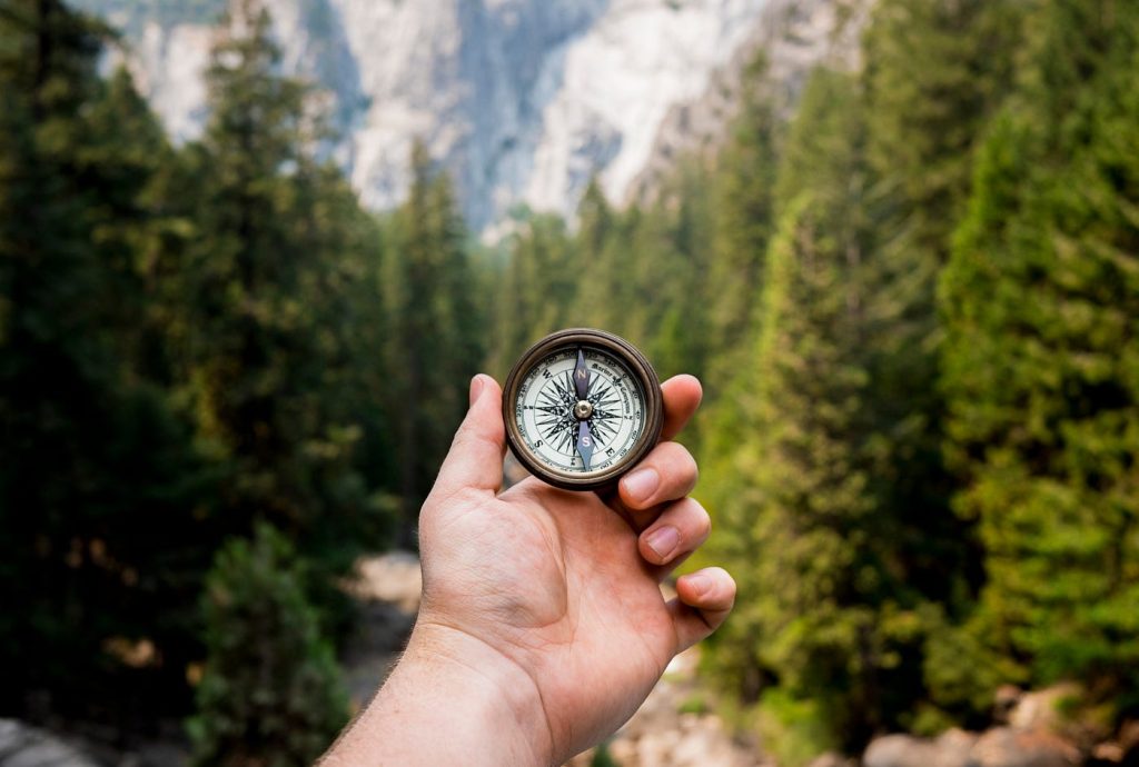
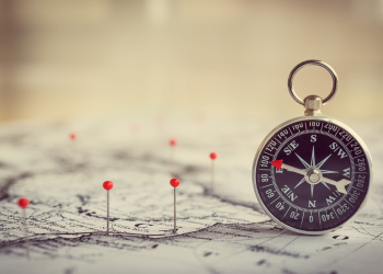
2. Traditional Navigation Tools: Map and Compass
Despite the proliferation of GPS devices and smartphone apps, the classic tools of map and compass remain indispensable in wilderness navigation. They do not rely on batteries and are less prone to failure under extreme conditions.
2.1 Using a Map
- Topographic Maps: These maps show the terrain’s contours and elevation, which are critical for determining your position and direction.
- Reading a Map: Orienting a map to the terrain is essential. This means aligning the map with the actual landscape, using identifiable landmarks and the terrain’s features (rivers, peaks, valleys) as references.
2.2 Compass Basics
- Understanding Bearings: A compass provides a bearing, which is the direction you are heading in relation to true north. Knowing how to take and follow a bearing is crucial.
- Navigating by Grid Lines: Grids on maps allow you to estimate your position and course, and combining this with a compass bearing helps you track your location.
- Adjusting for Magnetic Declination: The Earth’s magnetic field causes variation between true north and magnetic north. Understanding this declination is critical for accuracy.
2.3 Practical Skills
- Finding True North: The simplest method involves using the sun’s position (in the northern hemisphere, the sun is always in the southern sky). For an easier technique, use the compass to find true north.
- Following a Bearing: Set a bearing on your compass, and use landmarks or other visual cues to guide you along your path.
3. Navigating with GPS Technology
GPS technology has revolutionized how people navigate in the wilderness, offering real-time, precise location information. However, reliance on GPS requires understanding how to use the device effectively and its limitations.
3.1 GPS Devices
- Handheld GPS Units: These devices are robust, offering long battery life and the ability to store maps and waypoints. Models like the Garmin GPSMAP series are popular among outdoor enthusiasts.
- Smartphones with GPS Apps: While smartphones are more portable, their battery life can be short, and they depend on satellite signals. Offline maps, such as those on Gaia GPS or Komoot, are essential for wilderness navigation.
- GPS Accuracy: High-end GPS units can provide accuracy within 3 meters, which is highly beneficial when navigating in dense forests or vast open spaces.
3.2 Using GPS Effectively
- Setting Waypoints: A waypoint is a specific location marked on a GPS device. Setting waypoints when you start your journey (such as your starting point, campsites, or trailheads) is critical for reverse navigation if you get lost.
- Navigation in 3D: GPS devices can also track altitude, giving you the ability to understand your elevation in relation to nearby terrain features.
- Battery Management: GPS devices can quickly drain batteries, so knowing how to conserve power is crucial. Consider carrying spare batteries or a portable charger.
4. Orienteering: Navigating with Skill and Speed
Orienteering involves using a map, compass, and your own knowledge of the terrain to navigate to a series of checkpoints in the shortest time possible. This sport is a practical way to hone wilderness navigation skills and can be a valuable exercise for those preparing for long expeditions.
4.1 Orienteering Basics
- Route Choice: Orienteering requires evaluating terrain and choosing the most efficient route, whether it’s faster to climb over a ridge or navigate around a valley.
- Estimating Distance: Orienteers use pacing and timing to estimate how far they’ve traveled. For instance, knowing that your pace is 100 steps per 100 meters can help you gauge the distance between waypoints.
- Crossing Obstacles: Many courses involve natural obstacles like rivers or rock fields. Being able to use your compass to determine the best crossing points is crucial.
4.2 Advanced Techniques
- Attack Points: Orienteers often use a known feature, like a peak or a distinct valley, as an “attack point” to navigate toward a specific location.
- Contour Navigation: By understanding how the landscape’s contours work, you can adjust your navigation technique, using ridges or valleys as natural markers for progress.
5. Survival Techniques When Lost
Even the most experienced navigators can become disoriented or lost in the wilderness. Understanding how to survive while regaining your bearings is essential.
5.1 Stay Calm and Assess the Situation
- Stop, Think, Observe, Plan (STOP): This basic survival rule encourages individuals to take a moment to assess their situation. It helps reduce panic and leads to better decision-making.
- Determine Your Position: If you have a map and compass, try to figure out your location. If you’re using a GPS device, check your coordinates.
5.2 Shelter and Water
- Building a Shelter: If it’s unsafe to continue or weather conditions are poor, find or build shelter to protect yourself from exposure.
- Water Collection: Without clean water, survival becomes difficult. Learn techniques to collect and purify water in the wilderness. Carrying an ultralight water filter or chemical purification tablets is essential.
5.3 Signaling for Help
- Visual Signals: Use smoke, bright clothing, or large symbols like SOS to make yourself visible to rescuers or passing aircraft.
- Audible Signals: Whistles or shouts can attract attention from search parties.
5.4 Navigation While Lost
- Revisiting Landmarks: If you are truly lost and have no reference point, consider retracing your steps to find a familiar landmark.
- Using Natural Indicators: The position of the sun, the flow of rivers, and the growth of vegetation can all provide useful navigation information.
6. Advanced Wilderness Navigation Techniques
For advanced adventurers, additional techniques can be employed when navigating in more challenging environments, such as dense forests, deserts, or high-altitude terrains.
6.1 Celestial Navigation
- Using the Stars: In the Northern Hemisphere, the North Star (Polaris) offers a reliable guide to true north. In the Southern Hemisphere, the Southern Cross can be used for the same purpose.
- Sun Position: By noting the time of day and the position of the sun, one can estimate directions and plan a course.
6.2 Dead Reckoning
- Estimating Position: By knowing your last known position and the distance and direction traveled, you can estimate where you are. This technique involves measuring distances through pacing and using a compass for direction.
- Timing and Pacing: Knowing how long it takes to travel a certain distance helps you anticipate landmarks or natural features ahead.
7. Technological Challenges and Considerations
While technology has greatly improved navigation in the wilderness, it is important to understand its limitations.
7.1 GPS Reliability
- Signal Loss: Dense forests, canyons, or mountain ranges can obstruct GPS signals, rendering devices unreliable.
- Battery Dependence: Many GPS devices require regular battery changes or charging, which is a limitation in prolonged expeditions.
7.2 Satellite Phones and PLBs (Personal Locator Beacons)
- Satellite Communication: For emergencies, satellite phones can provide reliable communication, even in remote areas.
- PLBs: These devices allow you to send distress signals to rescue teams, offering peace of mind in case of serious trouble.
8. Risk Mitigation and Preparation
The best way to avoid getting lost is through preparation. Consider these strategies:
8.1 Route Planning
- Pre-trip Research: Study maps and satellite images of your route. Look for potential hazards such as rivers that might be difficult to cross or steep inclines.
- Leave a Trip Plan: Always inform someone about your route and expected return time. This will help rescuers if you do become lost.
8.2 Gear Checklist
- Navigation Tools: A map, compass, or GPS device is essential. Consider carrying a backup device in case one fails.
- Survival Gear: A multi-tool, fire-starting kit, first aid kit, and extra clothing can be lifesavers if you get lost or stranded.
8.3 Training and Practice
- Orienteering Courses: Attend courses to hone your navigation skills. Practical exercises can help you become more adept at using maps and compasses.
- Simulation: Practice using your navigation tools in various environments to get familiar with the process before you head into the wilderness.
9. Conclusion: Mastering Wilderness Navigation
Navigating the wilderness, especially in remote and unfamiliar areas, is an essential skill that can be the difference between a successful adventure and a life-threatening situation. By combining traditional methods such as map and compass with modern tools like GPS, and integrating survival skills into your navigation knowledge, you can mitigate the risks of getting lost and ensure a safer experience in the wild.
While technology offers convenience, the true value of wilderness navigation lies in understanding your environment, maintaining calm, and using your skills to orient yourself, whether you’re using the stars above, the landscape below, or the sophisticated tools in your pack. Mastering these techniques and preparing thoroughly will help you confidently navigate any wilderness, ensuring that the adventure remains an exciting challenge, rather than a dangerous ordeal.


