


Introduction
Becoming lost in unfamiliar terrain is one of the most common and dangerous situations faced by hikers, travelers, outdoor workers, field researchers, and survival enthusiasts. It can happen to anyone—regardless of experience level. Fog rolls in, trails disappear, storms distort visibility, or you lose track of your surroundings. Suddenly the familiar becomes unfamiliar, and every direction looks similar.
The question then becomes: How do you find direction when you are lost in complex terrain?
This extensive guide provides a professional-level, deeply detailed, 3200+ word analysis of direction-finding strategies for wilderness environments. It blends modern survival science with traditional fieldcraft, military land navigation techniques, natural observation methods, cognitive psychology, and real-world lessons from search-and-rescue (SAR) experts.
The result is a powerful, life-saving resource that teaches you how to regain control, re-establish orientation, and navigate toward safety—even when all tools fail.
PART I — Understanding What “Lost” Really Means
Before learning how to find direction, it’s essential to understand the psychology and mechanics of getting lost.
1. The Psychological Shift
Most people don’t realize they’re lost until panic symptoms appear:
- Disorientation
- Rapid breathing
- Physical tension
- Urge to move quickly
- Difficulty thinking clearly
SAR experts call this lost-person panic response. Recognizing it early is critical.
2. The “STOP” Method — Stabilizing Your Mind
Professionals use the STOP protocol:
- S – Stop moving (reduces risk of making things worse)
- T – Think about last known location
- O – Observe surroundings and environmental cues
- P – Plan actions intelligently
This mental reset is the foundation for all navigation techniques.
3. Common Causes of Getting Lost
Understanding the causes helps prevent future incidents:
- Poor visibility (fog, snow, nightfall)
- Overconfidence and poor planning
- Trail confusion (unmarked or branching paths)
- Relying entirely on electronics
- Fatigue reducing decision-making ability
- Terrain distortion (dense forest, canyons)
- Weather-driven landscape changes
Knowing why people get lost provides insight into how to regain direction.
PART II — Establishing Your Position: The “Last Known Point” Strategy
Professionals always start with what you know, not what you guess.
1. Identify the Last Known Point (LKP)
Ask yourself:
- When was the last time I knew exactly where I was?
- Was it a ridge, trail junction, river crossing, landmark?
- How far could I have traveled since then?
Even an approximate LKP dramatically narrows your search radius.
2. Recognize Terrain Drift
Lost individuals frequently drift:
- Uphill (following open terrain)
- Downhill (seeking easier movement)
- Toward water noise
- Along animal trails
Understanding your movement tendencies helps in reorienting effectively.
3. Use “Boxing” to Determine Your Area
If unsure of your LKP radius, create a mental box:
- Minimum distance you could have traveled
- Maximum distance possible
- Likely direction tendencies
This is crucial for orienting yourself when landmarks are scarce.
PART III — Using Natural Cues to Determine Direction
Nature provides abundant directional information. The key is understanding how to interpret the cues correctly.
SECTION A — Celestial Navigation (Sun, Stars, Moon)
1. Sun-Based Orientation
1.1 East–West Line (Daytime)
- Sun rises roughly in the east
- Sun sets roughly in the west
Though not perfectly accurate due to seasonal variation, it provides broad direction.
1.2 Shadow Stick Method
- Stick is placed vertically in the ground
- Mark tip of shadow (Point A)
- Wait 10–15 minutes
- Mark new shadow tip (Point B)
- Draw line A → B = West to East
This method works globally and is highly reliable.
2. Night Navigation with Stars
2.1 Northern Hemisphere: Polaris (North Star)
- Find the Big Dipper
- Draw line through the pointer stars
- Polaris = True North
2.2 Southern Hemisphere: Southern Cross
Extend the long axis four times to approximate the direction of True South.
3. Using the Moon
When the moon is waxing, its bright side points roughly west. When waning, it points east.
Though less precise, it helps when stars and sun are unavailable.
SECTION B — Landscape Interpretation (Terrain Association)
This is the most authentic, reliable method for direction-finding in complex terrain.
1. Rivers and Water Systems
Rivers always:
- Flow downhill
- Converge into larger valleys
General rule:
- Follow downstream to human settlements or major routes
- Follow upstream to mountain passes
Note: Flood zones and slippery rocks require extreme caution.
2. Valleys, Ridges, and Saddles
Terrain features provide directional clues:
- Ridges often run parallel and lead to higher ground
- Valleys lead downward and help orient movement
- Saddles indicate transitions between features
Understanding how ridgelines run reveals large-scale directional orientation even in poor visibility.
3. Wind Patterns
Prevailing winds shape:
- Snowdrifts
- Tree growth direction
- Sand dunes
These features subtly reveal dominant wind direction.
4. Vegetation Clues (Used Carefully)
Contrary to myth, moss is not a reliable directional marker.
Better indicators include:
- Tree growth leaning toward sunlight
- South-facing rock surfaces being drier in the northern hemisphere
- Lichen abundance on shaded (often northern) sides
These are supplementary clues, not primary indicators.
SECTION C — Sound and Water Indicators
Sound travels differently through terrain.
1. Moving Toward Water Noise
Sounds of water help orient you:
- Downhill flow
- Narrow canyon acoustics
2. Human Activity Noise
Roads, machinery, and voices provide directional hints.
PART IV — Finding Direction with Improvised Tools
Even without a compass, you can make directional devices.
1. Improvised Magnetic Compass
Materials:
- Metal needle
- Cloth or hair
- Water container
- Magnetizing source (fabric, hair, or even rubbing on clothing)
Steps:
- Rub needle repeatedly in one direction
- Float it on a leaf or small object
- Needle aligns north–south
This is accurate enough for broad navigation.
2. Watch Method (Analog or Improvised)
Northern Hemisphere
- Point hour hand at the sun
- Bisect the angle between hour hand & 12 o’clock
- That line = South
Southern Hemisphere
Reverse the method.
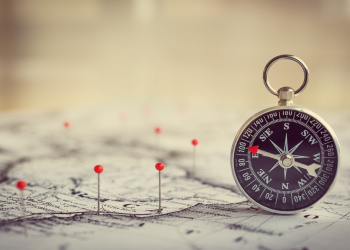
PART V — Using Modern Tools Correctly (When Available)
Navigation errors occur because people misuse tools. Understanding limitations is key.
1. GPS Limitations
- Obstructed signals in canyons
- Rapid battery drain
- Errors in dense forests
- Lack of detailed terrain understanding
GPS should supplement, not replace, map-based orientation.
2. Smartphone Maps
Offline maps are essential—signal-dependent apps often fail.
3. Emergency Beacons
Devices like PLBs or satellite messengers guide rescue teams, but require:
- Clear sky access
- Proper activation
- No physical obstruction
PART VI — The “Reorientation Protocol”: Step-by-Step Action Plan
If you’re lost, follow this structured method used by experts.
Step 1: STOP & Stabilize
Don’t let panic dictate movement.
Step 2: Situational Reconstruction
Recreate the route mentally:
- Terrain changes
- Significant landmarks
- Distances covered
- Time intervals
Step 3: Environmental Assessment
Look for:
- High ground
- Waterways
- Direction of sunlight
- Landmarks
Step 4: Establish a Directional Baseline
Choose:
- North–south
- East–west
Based on natural cues.
Step 5: Gain High Ground (Safely)
Reaching a vantage point reveals:
- Terrain structure
- Water pathways
- Road grids
- Clearings
- Trail continuity
Avoid climbing unstable slopes.
Step 6: Choose a Strategy
Option A — Stay Put
Best if:
- Injured
- Nightfall approaching
- Severe weather
- No clear path
Option B — Self-Rescue
Choose if:
- You have clear direction
- Terrain is manageable
- Weather stable
Step 7: Set Travel Rules
- Travel in straight lines where possible
- Mark your path (stones, branches, scratches)
- Pace count
- Stop every 15 minutes to reassess
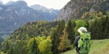
PART VII — Terrain-Specific Strategies
Different environments require specialized approaches.
1. Dense Forest (Low Visibility)
Challenges:
- Limited landmarks
- Terrain distortion
- Sunlight blocked
Strategies:
- Keep to ridgelines
- Use sound-based navigation
- Mark movement regularly
2. Desert Terrain
Challenges:
- Featureless landscape
- Extreme heat
- Mirage distortion
Strategies:
- Navigate during early morning or late afternoon
- Use shadows for direction
- Identify dune patterns (wind-created)
3. Mountain Terrain
Challenges:
- Steep slopes
- Cliff hazards
- Rapid weather change
Strategies:
- Stay on ridgelines
- Avoid gullies
- Use contour-based navigation
4. Snowfields & Whiteout Conditions
Challenges:
- Zero visibility
- Disappearing tracks
- Hypothermia risk
Strategies:
- Walk with rope-line if available
- Use compass or shadow direction
- Stay oriented with sound cues
5. Canyon or River Gorge
Challenges:
- Limited escape routes
- Echo distortion
- Bend-driven disorientation
Strategies:
- Follow water flows
- Avoid climbing canyon walls
- Track sunlight path
PART VIII — Human Behavior Patterns When Lost
SAR research reveals predictable patterns.
1. Tendency to Move Faster When Lost
Increases danger and leads farther off course.
2. Following Terrain of Least Resistance
Usually downhill, often toward water.
3. Ignoring Landmarks
Tunnel vision prevents recognition of key features.
Understanding these tendencies helps override instinct-driven mistakes.
PART IX — Creating a “Directional Mindset”
A strong directional mindset prevents disorientation.
1. Build Mental Maps Continuously
Always visualize:
- Relative position
- Cardinal directions
- Terrain structure
2. Constant Micro-Check of Environment
Every few minutes:
- Look behind you
- Note sky changes
- Identify new landmarks
3. Develop “Directional Memory”
Practiced via:
- Orienteering
- Map training
- Field exercises
PART X — Preventing Disorientation in the First Place
The best navigation skills are used before you get lost.
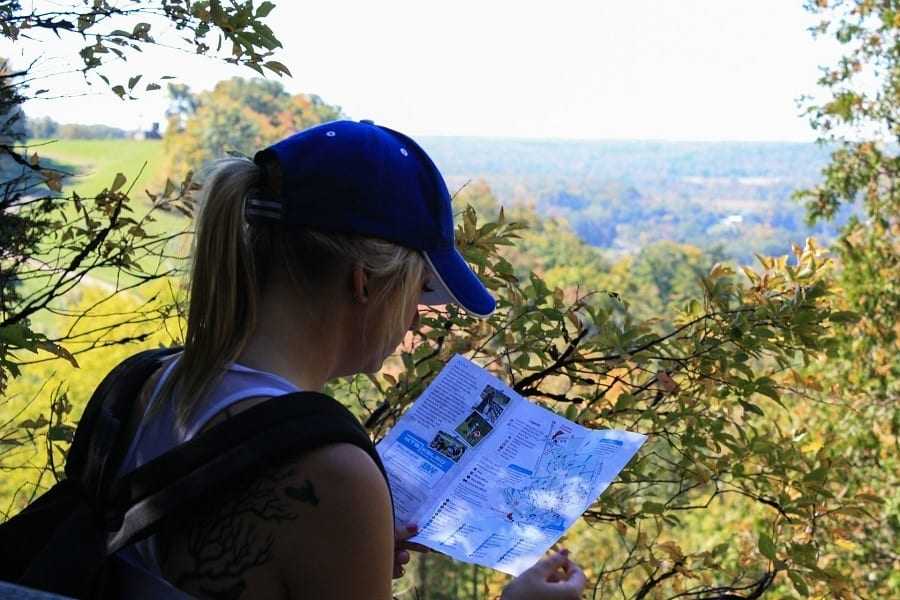
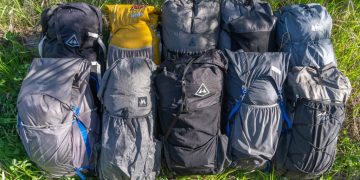
1. Always Carry Essentials
- Map
- Compass
- Marker
- Flashlight
- Whistle
- Backup battery
2. Pre-Trip Planning
Study:
- Contour patterns
- Landmark positions
- Elevation profiles
- Water sources
3. Time & Distance Awareness
Track:
- How far you’ve walked
- Pace count
- Time elapsed
4. Checkpoints & Handrails
Use natural and man-made features to guide travel.
Conclusion
Finding direction when lost in unfamiliar terrain is both a science and an art. It requires calm thinking, methodical observation, and an understanding of natural patterns, terrain geometry, celestial cues, and human behavior. While technology can help, true safety lies in the knowledge you carry in your mind and the discipline you maintain under stress.


